Inciweb’s latest on the Gap Fire (tag: sbgapfire. Hashtag: #sbgapfire) is 10 hours old, it says (as of 12:17am Thursday morning). Most of KEYT‘s 11pm newscast was devoted to the fire. Currently they’re reporting 1200 acres burned, 5% containment. The winds are not Santa Ana grade, but do come down from the NNW, flowing SSE over the Santa Ynez mountains (where the fire burns, above Santa Barbara and Goleta), directly toward town (and also in to the path of areas already burned by backfires, one hopes). KEYT also reported 10-13mph winds, with possible gusts up to 35. But the reporter on site said winds below, where houses are threatened, were calm.
Meanwhile ash is falling and the smell of smoke is strong. It’s stuffy, but we have all our windows shut here.
We also had a power outage. KEYT reported that nearly all of Santa Barbara and Goleta were knocked out by smoke affecting the main power lines into town, which come over the mountains from the North. (The other main power lines come over the mountains near Gibraltar Peak.) We came back on, but around 70,000 homes are still without power. The County of Santa Barbara has more on the front page of its website (that last link), but no direct link to any single report.
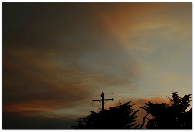
I’ll put up some pictures shortly, taken from our neighborhood close to the center of Santa Barbara itself, about 10 miles by air from the fire center. [Later: It wasn’t easy, since the Net’s speed has been way down… no doubt Cox is affected by this… but I got at least one picture up: the one above.]
Tuning around the radio dial, I only hear fire news right now on KCSB/91.9 from UCSB, alternating between English and Spanish. The station’s many Web streams are here.
More from The Independent (also on its fire page), Noozhawk, Edhat…
Here is a very deep history of wildfires around Santa Barbara. Scary and important. And here is my post about them, from the last time a fire threatened. I also had some ideas last year about public radio filling the hole left by departed news and “full service” commercial stations (all of which are gone from Santa Barbara). It was on my old blog here, but seems to be gone right now.
[Later…] The Net from Cox, our cable Internet provider, is down. The borrowed Sprint EvDO card, however, works perfectly. I even managed to upload the rest of my fire smoke photo set to Flickr.
Leave a Reply