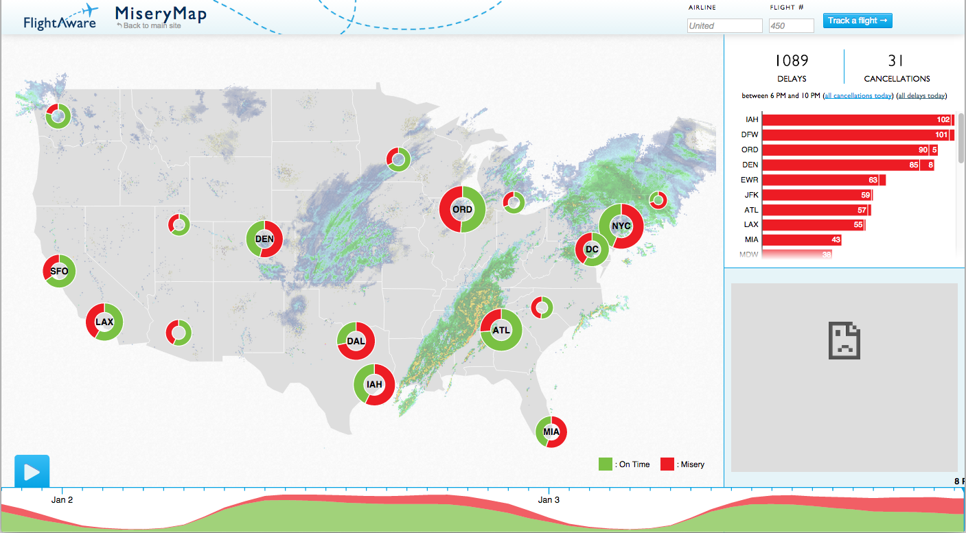
 That’s FlightAware‘s MiseryMap. Go there now, click on the blue “play” button and watch what happens. If you’re close to now (8:56pm EST), you’ll see what weather does directly to major airports in Chicago, New York and Atlanta, and indirectly (by delayed flights due to unavailable airplanes, mostly) to Houston, Dallas, Los Angeles, Miami, etc. If you’re at some other time in the future, it will still show weather and flight delays, because we always have both.
The MiseryMap is also one of the coolest and most useful examples of data visualization on the Web. And a trifecta winner for weather, aviation and geography freaks like me.
Leave a Reply