Here’s a not-too-pretty proof of concept script that hastily glues together several blog posts, as noted in the code.
The script takes the following steps:
- Takes the path to a .shp file
- Reprojects the .shp file to 4326 (without checking if it’s already in 4326–DOH!) (via Python GDAL/OGR Cookbook)
- Converts the .shp to GEOJSON (by Shapefile to GeoJSON)
- Creates a Leaflet page using Folium (using Folium)
- Does all this using way too many libraries:)
from __future__ import print_function
import os, sys
import json
from osgeo import ogr, osr
import shapefile
import folium
def msg(s): print (s)
def dashes(): msg(40*'-')
def msgt(s): dashes(); msg(s); dashes()
def msgx(s): dashes(); msg('ERROR'); msg(s); dashes(); sys.exit(0)
def get_output_fname(fname, new_suffix):
fparts = fname.split('.')
if len(fparts[-1]) == 3:
return '.'.join(fparts[:-1]) + new_suffix + '.' + fparts[-1]
return fname + new_suffix
def reproject_to_4326(shape_fname):
"""Re-project the shapefile to a 4326. From the Python GDAL/OGR Cookbook
Source: http://pcjericks.github.io/py-gdalogr-cookbook/projection.html#reproject-a-layer
:param shape_fname: full file path to a shapefile (.shp)
:returns: full file path to a shapefile reprojected as 4326
"""
if not os.path.isfile(shape_fname):
msgx('File not found: %s' % shape_fname)
driver = ogr.GetDriverByName('ESRI Shapefile')
inDataSet = driver.Open(shape_fname)
# input SpatialReference
inLayer = inDataSet.GetLayer()
inSpatialRef = inLayer.GetSpatialRef()
# output SpatialReference
outSpatialRef = osr.SpatialReference()
outSpatialRef.ImportFromEPSG(4326)
# create the CoordinateTransformation
coordTrans = osr.CoordinateTransformation(inSpatialRef, outSpatialRef)
# create the output layer
outputShapefile = get_output_fname(shape_fname, '_4326')
#msg('output file: %s' % outputShapefile)
if os.path.exists(outputShapefile):
driver.DeleteDataSource(outputShapefile)
outDataSet = driver.CreateDataSource(outputShapefile)
outLayer = outDataSet.CreateLayer("basemap_4326", geom_type=ogr.wkbMultiPolygon)
# add fields
inLayerDefn = inLayer.GetLayerDefn()
for i in range(0, inLayerDefn.GetFieldCount()):
fieldDefn = inLayerDefn.GetFieldDefn(i)
outLayer.CreateField(fieldDefn)
# get the output layer's feature definition
outLayerDefn = outLayer.GetLayerDefn()
# loop through the input features
inFeature = inLayer.GetNextFeature()
while inFeature:
# get the input geometry
geom = inFeature.GetGeometryRef()
# reproject the geometry
geom.Transform(coordTrans)
# create a new feature
outFeature = ogr.Feature(outLayerDefn)
# set the geometry and attribute
outFeature.SetGeometry(geom)
for i in range(0, outLayerDefn.GetFieldCount()):
outFeature.SetField(outLayerDefn.GetFieldDefn(i).GetNameRef(), inFeature.GetField(i))
# add the feature to the shapefile
outLayer.CreateFeature(outFeature)
# destroy the features and get the next input feature
outFeature.Destroy()
inFeature.Destroy()
inFeature = inLayer.GetNextFeature()
# close the shapefiles
inDataSet.Destroy()
outDataSet.Destroy()
msg('output file: %s' % outputShapefile)
return outputShapefile
def convert_shp_to_geojson(shape_fname):
"""Using the pyshp library, https://github.com/GeospatialPython/pyshp, convert the shapefile to JSON
Code is from this example: http://geospatialpython.com/2013/07/shapefile-to-geojson.html
:param shape_fname: full file path to a shapefile (.shp)
:returns: full file path to a GEOJSON representation of the shapefile
(recheck/redo using gdal)
"""
if not os.path.isfile(shape_fname):
msgx('File not found: %s' % shape_fname)
# Read the shapefile
try:
reader = shapefile.Reader(shape_fname)
except:
msgx('Failed to read shapefile: %s' % shape_fname)
fields = reader.fields[1:]
field_names = [field[0] for field in fields]
output_buffer = []
for sr in reader.shapeRecords():
atr = dict(zip(field_names, sr.record))
geom = sr.shape.__geo_interface__
output_buffer.append(dict(type="Feature", geometry=geom, properties=atr))
# write the GeoJSON file
out_fname = os.path.join('page-out', os.path.basename(shape_fname).replace('.shp', '.json'))
geojson = open(out_fname, "w")
geojson.write(json.dumps({"type": "FeatureCollection","features": output_buffer}, indent=2) + "n")
geojson.close()
msg('file written: %s' % out_fname)
return out_fname
def make_leaflet_page(geojson_file, ouput_html_fname):
"""Using folium, make an HTML page using GEOJSON input
examples: https://github.com/wrobstory/folium
:param geojson_file: full file path to a GEO JSON file
:param ouput_html_fname: name of HTML file to create (will only use the basename)
"""
if not os.path.isfile(geojson_file):
msgx('File not found: %s' % geojson_file)
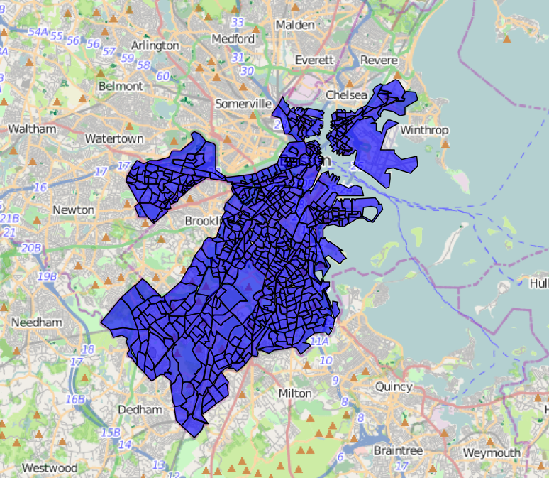
# Boston
mboston = folium.Map(location=[ 42.3267154, -71.1512353])
mboston.geo_json(geojson_file)
#mboston.geo_json('income.json')
ouput_html_fname = os.path.basename(ouput_html_fname)
mboston.create_map(path=ouput_html_fname)
print ('file written', ouput_html_fname)
if __name__=='__main__':
reprojected_fname = reproject_to_4326('data/social_disorder_in_boston/social_disorder_in_boston_yqh.shp')
geojson_fname = convert_shp_to_geojson(reprojected_fname)
make_leaflet_page(geojson_fname, 'disorder.html')
My project is based on GIS in which i have two main tasks:
1. Import shapefile- I have to import shapefile (shapefile to geojson).
2. Export shapefile- After performing operations/editing (draw any thing on that shapefile ) i want to create duplicate shapefile as i clicked on export button. (That newly layer/shapefile will be the copy of imported shapefile).
Now i am unable to export shapefile and it’s supportive file: shp, shx, prj, dbf.
help me